Eén miljard kleinschalige boeren evalueren vanuit de ruimte - Beter herbebossen dankzij analyse van satellietgegevens
Keywords: satellietdata, herbebossing, landbouw, global-warming, data-analyse
Meer dan één miljard boeren kiezen vandaag voor het planten van bomen op hun land. Vertegenwoordigers van het Akkoord van Parijs (2015) erkennen het feit dat we de vooropgestelde doelstellingen omtrent de opwarming van de aarde niet halen zonder de hulp van dit gigantisch aantal onafhankelijke boeren. Wel stelt zich de vraag: hoe evalueer je zoveel individuele boeren, verspreid over de hele wereld? De vertegenwoordigers van het klimaatakkoord beargumenteren dat het té duur is om dit op individuele basis te organiseren, maar recente ontwikkelingen in bestaande technologieën creëren nieuwe mogelijkheden.
Herbebossings- of andere ontwikkelingsorganisaties doen vaak interventies zonder te meten of ze daadwerkelijk een positieve impact hebben op hun omgeving. Data gebruiken als maatstaf bij herbebossing maakt het monitoren en evalueren van het project een heel stuk gemakkelijker.
Een nieuwe studie door Pello Múgica Gonzalez (2018) toont aan dat de efficiëntie en impact van herbebossingsprojecten aanzienlijk kunnen verbeteren door een analyse van satellietgegevens. Deze studie omvat een baanbrekende methodologie om dergelijke herbebossingsprojecten te evalueren vanuit de ruimte, die overigens goedkoop, toegankelijk en schaalbaar is.
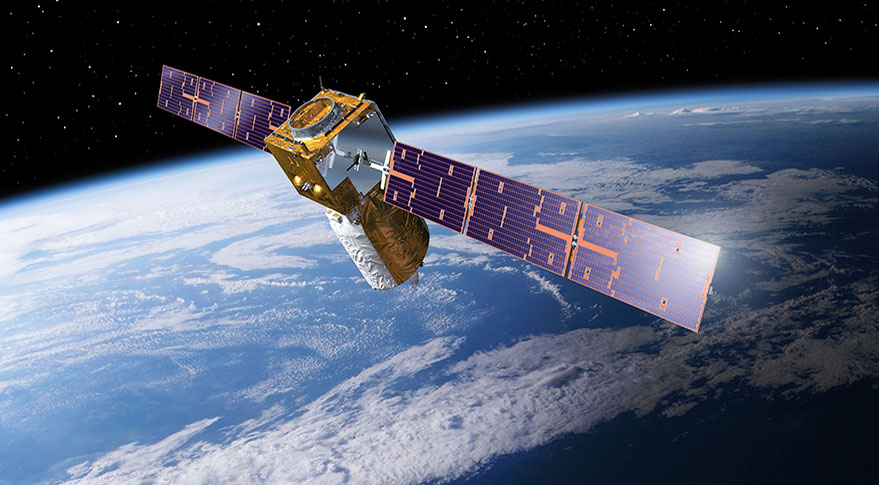
Satellietdata. Wat kun je er mee?
Enkele publieke observatiesatellieten draaien in een baan om de aarde. Er is gratis toegang tot alle data en momentopnames die ze dagelijks vastleggen. Via het internet vind je verschillende manieren om tot deze hoogtechnologische speeltjes toegang te krijgen. Het meest uitgebreide en gebruiksvriendelijke instrument is waarschijnlijk de goed gedocumenteerde Google Earth Engine, gelimiteerd tot gebruik voor ontwikkeling, evaluatie, onderzoek en educatieve doeleinden.
"Landsat [world’s first public earth observation program from NASA] has been producing Big Data since before data was big." — Robinson Meyer, The Atlantic, Apr 16, 2015
Satellietdata zijn veel meer dan enkel statische momentopnamen. De sensoren kunnen veel meer reflecties van golflengten registreren dan het menselijke oog. Zo kunnen wij als mens enkel kleuren zien, terwijl de sensor van een satelliet onder andere ook infrarood kan vastleggen. Dat laatste is extreem handig voor het detecteren van bijvoorbeeld gezonde vegetatie.
Positieve impact op lange termijn dankzij evaluatie vanuit de ruimte
De verandering in vegetatie monitoren vanuit de ruimte is een geweldige oplossing voor projecten wereldwijd. De studie van Múgica Gonzalez gaat nog een stap verder door deze satellietdata te combineren met data die werden verzameld op de aarde. Deze combinatie laat diepere analyses toe met betrekking tot de effectiviteit van het herbebossingsproject. Op die manier kunnen projectmanagers disfunctionaliteiten en opportuniteiten identificeren die een systematische impact hebben op lange termijn, en kan elke projectgebonden parameter (zoals bijvoorbeeld toegepaste snoei- en planttechnieken, gebruikte materialen, ...) worden afgetoetst.
Taking Root, een Canadese NGO, actief in Nicaragua, die meewerkte aan dit onderzoek, toont als pionier in herbebossing met de hulp van data aan dat hun werkwijze gunstig is voor alle stakeholders op lange termijn.
Múgica Gonzalez, net afgestudeerd aan UGent als Handelsingenieur, doet met deze studie een significante bijdrage aan de strijd tegen de opwarming van de aarde, waar efficiëntie en effectiviteit van uiterst belang zijn.
Bibliografie
Andam, K. S., Ferraro, P. J., Pfaff, A., Sanchez-Azofeifa, G. A., & Robalino, J. A. (2008). Measuring the effectiveness of protected area networks in reducing deforestation. Proceedings of the National Academy of Sciences, 105(42), 16089-16094. doi:10.1073/pnas.0800437105
Andersen, L. E. (2002). The dynamics of deforestation and economic growth in the Brazilian Amazon: Cambridge University Press.
Arriagada, R. A., Ferraro, P. J., Sills, E. O., Pattanayak, S. K., & Cordero-Sancho, S. (2012). Do payments for environmental services affect forest cover? A farm-level evaluation from Costa Rica. Land Economics, 88(2), 382-399.
Asrar, G., Fuchs, M., Kanemasu, E., & Hatfield, J. (1984). Estimating Absorbed Photosynthetic Radiation and Leaf Area Index from Spectral Reflectance in Wheat 1. Agronomy journal, 76(2), 300-306.
Barr, D. J., Levy, R., Scheepers, C., & Tily, H. J. (2013). Random effects structure for confirmatory hypothesis testing: Keep it maximal. Journal of memory and language, 68(3), 255-278.
Bawa, K., Rose, J., Ganeshaiah, K., Barve, N., Kiran, M., & Umashaanker, R. (2002). Assessing biodiversity from space: an example from the Western Ghats, India. Conservation Ecology, 6(2), 7.
BenYishay, A., Parks, B., Runfola, D., & Trichler, R. (2016). Forest cover impacts of Chinese development projects in ecologically sensitive areas. Paper presented at the SAIS CARI 2016 Conference. October.
BenYishay, A., Rotberg, R., Wells, J., Lv, Z., Goodman, S., Kovacevic, L., & Runfola, D. (2017). Geocoding Afrobarometer rounds 1–6: methodology & data quality. AidData.
BenYishay, A., Runfola, D., & Buntaine, M. (2015). Going Geospatial with Impact Evaluations. Retrieved from https://usaidlearninglab.org/events/geospatial-impact-evaluations:
BenYishay, A., Runfola, D., Trichler, R., Dolan, C., Goodman, S., Parks, B., . . . Anand, A. (2017). A Primer on Geospatial Impact Evaluation Methods, Tools, and Applications. AidData Working Paper #44.
Bishop, J., & Pagiola, S. (2012). Selling forest environmental services: market-based mechanisms for conservation and development: Taylor & Francis.
Borlagdan, S.B., Guiang, E.S., Pulhin, J.M., 2001. Community-Based Forest Management in the Philippines: A Preliminary Assessment. Institute of Philippine Culture, Ateneo de Manila University, Philippines.
Buchanan, G. M., Parks, B. C., Donald, P. F., O’Donnell, B. F., Runfola, D., Swaddle, J. P., & Butchart, S. (2016). The Impacts of World Bank development projects on sites of high biodiversity importance. url: http://aiddata. org/sites/default/files/wps20_world_bank_ biodiversity_0. pdf (visited on 11/21/2016).
Buntaine, M. T., Hamilton, S. E., & Millones, M. (2015). Titling community land to prevent deforestation: An evaluation of a best-case program in Morona-Santiago, Ecuador. Global Environmental Change, 33, 32-43.
Butt, M. J., Waqas, A., Mahmood, R., & Group, H. R. (2010). The combined effect of vegetation and soil erosion in the water resource management. Water resources management, 24(13), 3701-3714.
Campbell, S., & Hofmann, S. C. e. a. (2014). Independent external evaluation UN Peacebuilding Fund Project portfolio in Burundi 2007–2013. 85 p.
Combalicer, M. S., Kim, D., Lee, D. K., Combalicer, E. A., Cruz, R. V. O., & Im, S. (2011). Changes in the forest landscape of Mt. Makiling Forest Reserve, Philippines. Forest Science and Technology, 7(2), 60-67. doi:10.1080/21580103.2011.572615
Deininger, K., & Minten, B. (2002). Determinants of deforestation and the economics of protection: an application to Mexico. American Journal of Agricultural Economics, 84(4), 943-960.
Deng, X., Huang, J., Uchida, E., Rozelle, S., & Gibson, J. (2011). Pressure cookers or pressure valves: do roads lead to deforestation in China? Journal of Environmental Economics and Management, 61(1), 79-94.
Dolan, C., Grepin, K., G., M., & J., T. (2017). The Impact of an Insecticide Treated Bednet Campaign on All-Cause Child Mortality: A Geospatial Impact Evaluation from the Democratic Republic of Congo. Retrieved from
Dudley, N., Mansourian, S., & Vallauri, D. (2005). Forest landscape restoration in context. In Forest Restoration in Landscapes (pp. 3-7): Springer.
Eastman, J. R., Sangermano, F., Machado, E. A., Rogan, J., & Anyamba, A. (2013). Global trends in seasonality of normalized difference vegetation index (NDVI), 1982–2011. Remote Sensing, 5(10), 4799-4818.
Eckholm, E. (1979). Planting for the future: forestry for human needs.
Ellis, S., Holahan, C., Klynstra, J., Madison, J., & Robison, R. (2013). The feasibility of a local reforestation project at Colgate University. In.
Elster, C. (2000). Reasons for reforestation success and failure with three mangrove species in Colombia. Forest Ecology and Management, 131(1-3), 201-214.
ESA. (2015). Sentinel-2 User Handbook.
Fadaei, H., Sakai, T., Yoshimura, T., Moriya, K., & Torii, K. (2009). Relationship between tree density and vegetation index of juniper forest in the northeast of Iran. Paper presented at the Proceedings of the 30th Asian Conference on Remote Sensing (ACRS), CD-ROM.
Fensholt, R., & Sandholt, I. (2005). Evaluation of MODIS and NOAA AVHRR vegetation indices with in situ measurements in a semi‐arid environment. International Journal of Remote Sensing, 26(12), 2561-2594.
Foster, J., Lowe, A., & Winkelman, S. (2011). The value of green infrastructure for urban climate adaptation. Center for Clean Air Policy, 750, 1-52.
Funk, C. C., & Brown, M. E. (2006). Intra-seasonal NDVI change projections in semi-arid Africa. Remote Sensing of Environment, 101(2), 249-256.
Gaitán, J. J., Bran, D., Oliva, G., Ciari, G., Nakamatsu, V., Salomone, J., . . . Humano, G. (2013). Evaluating the performance of multiple remote sensing indices to predict the spatial variability of ecosystem structure and functioning in Patagonian steppes. Ecological indicators, 34, 181-191.
Gelman, A., & Hill, J. (2006). Data analysis using regression and multilevel/hierarchical models: Cambridge university press.
Gillespie, T., Saatchi, S., Pau, S., Bohlman, S., Giorgi, A., & Lewis, S. (2009). Towards quantifying tropical tree species richness in tropical forests. International Journal of Remote Sensing, 30(6), 1629-1634.
Guiang, E. S., Borlagdan, S. B., & Pulhin, J. M. (2001). Community-based forest management in the Philippines: a preliminary assessment. Institute of Philippine Culture, Ateneo de Manila University.
Günter, S., Gonzalez, P., Álvarez, G., Aguirre, N., Palomeque, X., Haubrich, F., & Weber, M. (2009). Determinants for successful reforestation of abandoned pastures in the Andes: soil conditions and vegetation cover. Forest Ecology and Management, 258(2), 81-91.
Hansen, M. C., Potapov, P. V., Moore, R., Hancher, M., Turubanova, S., Tyukavina, A., . . . Loveland, T. (2013). High-resolution global maps of 21st-century forest cover change. science, 342(6160), 850-853.
Hao, F., Zhang, X., Ouyang, W., Skidmore, A. K., & Toxopeus, A. (2012). Vegetation NDVI linked to temperature and precipitation in the upper catchments of Yellow River. Environmental Modeling & Assessment, 17(4), 389-398.
Hernández-Stefanoni, J. L., Gallardo-Cruz, J. A., Meave, J. A., & Dupuy, J. M. (2011). Combining geostatistical models and remotely sensed data to improve tropical tree richness mapping. Ecological indicators, 11(5), 1046-1056.
Huete, A., Didan, K., Miura, T., Rodriguez, E. P., Gao, X., & Ferreira, L. G. (2002). Overview of the radiometric and biophysical performance of the MODIS vegetation indices. Remote Sensing of Environment, 83(1-2), 195-213.
Keiffer, C. H. (1999). Implications of Reforestation: Controlling Deer Browsing And Competing Vegetation. Miami University,
Keleş, S., & Başkent, E. (2007). Modelling and Analyzing Timber Production and Carbon Sequestration Values of Forest Ecosystems: A Case Study. Polish Journal of Environmental Studies, 16(3).
Konijnendijk, C. C., Ricard, R. M., Kenney, A., & Randrup, T. B. (2006). Defining urban forestry–A comparative perspective of North America and Europe. Urban forestry & urban greening, 4(3-4), 93-103.
Kruse, S. E., Kyllönen, T., Ojanperä, S., Riddell, R., & Vielajus, J. (1997). Searching for Impact and Methods: NGO Evaluation Synthesis Study, Report Prepared for the OECD/DAC Expert Group on Evaluation. Helsinki: University of Helsinki (Institute of Development Studies); online: www. valt. helsinki. fi/ids/ngo.
Landell-Mills, N., & Porras, I. T. (2002). Silver bullet or fools' gold?: a global review of markets for forest environmental services and their impact on the poor.
Le, H. D., Smith, C., & Herbohn, J. (2014). What drives the success of reforestation projects in tropical developing countries? The case of the Philippines. Global Environmental Change, 24, 334-348.
Le, H. D., Smith, C., Herbohn, J., & Harrison, S. (2011). More than just trees: Assessing reforestation success in tropical developing countries. Journal of Rural Studies, 1-15.
Le, H. D., Smith, C., Herbohn, J., & Harrison, S. (2012). More than just trees: assessing reforestation success in tropical developing countries. Journal of Rural Studies, 28(1), 5-19.
Ledig, F. T., & Kitzmiller, J. H. (1992). Genetic strategies for reforestation in the face of global climate change. Forest Ecology and Management, 50(1-2), 153-169.
Levin, N., Shmida, A., Levanoni, O., Tamari, H., & Kark, S. (2007). Predicting mountain plant richness and rarity from space using satellite‐derived vegetation indices. Diversity and Distributions, 13(6), 692-703.
Maginnis, S., Rietbergen-McCracken, J., & Sarre, A. (2012). The forest landscape restoration handbook: Routledge.
Mansourian, S., & Vallauri, D. (2005). Forest restoration in landscapes: beyond planting trees: Springer Science & Business Media.
Marden, M. (2012). Effectiveness of reforestation in erosion mitigation and implications for future sediment yields, East Coast catchments, New Zealand: a review. New Zealand Geographer, 68(1), 24-35.
Mcfarland, T., Van Riper III, C., & Johnson, G. (2012). Evaluation of NDVI to assess avian abundance and richness along the upper San Pedro River. Journal of Arid Environments, 77, 45-53.
Mohammadi, J., & Shataee, S. (2010). Possibility investigation of tree diversity mapping using Landsat ETM+ data in the Hyrcanian forests of Iran. Remote Sensing of Environment, 114(7), 1504-1512.
Morikawa, R. (2014). Remote sensing tools for evaluating poverty alleviation projects: A case study in Tanzania. Procedia Engineering, 78, 178-187.
Muhammed, A. W. (2017). Interpolation and Extrapolation. Retrieved from https://www.researchgate.net/publication/313359516_Interpolation_and_Ex…
Myneni, R. B., Hall, F. G., Sellers, P. J., & Marshak, A. L. (1995). The interpretation of spectral vegetation indexes. IEEE Transactions on Geoscience and Remote Sensing, 33(2), 481-486.
Nawir, A. A., & Rumboko, L. (2007). Forest rehabilitation in Indonesia: where to after more than three decades? : Center for International Forestry Research (CIFOR).
Nowak, D. J., Crane, D. E., & Stevens, J. C. (2006). Air pollution removal by urban trees and shrubs in the United States. Urban forestry & urban greening, 4(3-4), 115-123.
Oindo, B. O. (2008). Understanding the relationship between environmental energy availability and bird species richness in Kenya using remote sensing and ancillary data. The Open Remote Sensing Journal, 1, 1-6.
Paoletti, E., Bardelli, T., Giovannini, G., & Pecchioli, L. (2011). Air quality impact of an urban park over time. Procedia Environmental Sciences, 4, 10-16.
Parviainen, M., Luoto, M., & Heikkinen, R. K. (2009). The role of local and landscape level measures of greenness in modelling boreal plant species richness. Ecological Modelling, 220(20), 2690-2701.
Pau, S., Gillespie, T. W., & Wolkovich, E. M. (2012). Dissecting NDVI–species richness relationships in Hawaiian dry forests. Journal of Biogeography, 39(9), 1678-1686.
Perrin, B. (2012). Linking monitoring and evaluation to impact evaluation. Impact Evaluation Notes (2).
Pettorelli, N., Vik, J. O., Mysterud, A., Gaillard, J.-M., Tucker, C. J., & Stenseth, N. C. (2005). Using the satellite-derived NDVI to assess ecological responses to environmental change. Trends in ecology & evolution, 20(9), 503-510.
Poveda, G., Jaramillo, A., Gil, M. M., Quiceno, N., & Mantilla, R. I. (2001). Seasonally in ENSO‐related precipitation, river discharges, soil moisture, and vegetation index in Colombia. Water resources research, 37(8), 2169-2178.
Psomas, A., Kneubühler, M., Huber, S., Itten, K., & Zimmermann, N. (2011). Hyperspectral remote sensing for estimating aboveground biomass and for exploring species richness patterns of grassland habitats. International Journal of Remote Sensing, 32(24), 9007-9031.
Qiao, F., & Rozelle, S. (1998). Tenure of forest land and the development of forestry sector. Problems of Agricultural Economy, 7(5), 23-29.
Rawat, J., & Kumar, M. (2015). Monitoring land use/cover change using remote sensing and GIS techniques: A case study of Hawalbagh block, district Almora, Uttarakhand, India. The Egyptian Journal of Remote Sensing and Space Science, 18(1), 77-84.
Reed, B. C., Brown, J. F., VanderZee, D., Loveland, T. R., Merchant, J. W., & Ohlen, D. O. (1994). Measuring phenological variability from satellite imagery. Journal of vegetation science, 5(5), 703-714.
Running, S. W. (1990). Estimating terrestrial primary productivity by combining remote sensing and ecosystem simulation. In Remote sensing of biosphere functioning (pp. 65-86): Springer.
Sabins, F. F. (1999). Remote sensing for mineral exploration. Ore Geology Reviews, 14(3-4), 157-183.
Sauer, T. J., James, D. E., Cambardella, C. A., & Hernandez-Ramirez, G. (2012). Soil properties following reforestation or afforestation of marginal cropland. Plant and soil, 360(1-2), 375-390.
Schielzeth, H., & Forstmeier, W. (2008). Conclusions beyond support: overconfident estimates in mixed models. Behavioral Ecology, 20(2), 416-420.
Sedda, L., Tatem, A. J., Morley, D. W., Atkinson, P. M., Wardrop, N. A., Pezzulo, C., . . . Rogers, D. J. (2015). Poverty, health and satellite-derived vegetation indices: their inter-spatial relationship in West Africa. International health, 7(2), 99-106.
Sellers, P., Berry, J., Collatz, G., Field, C., & Hall, F. (1992). Canopy reflectance, photosynthesis, and transpiration. III. A reanalysis using improved leaf models and a new canopy integration scheme. Remote Sensing of Environment, 42(3), 187-216.
Shea, K. L., & Stange, E. E. (1998). Effects of deer browsing, fabric mats, and tree shelters on Quercus rubra seedlings. Restoration Ecology, 6(1), 29-34.
Souza, A. A., Galvão, L. S., & Santos, J. R. (2010). Relationships between Hyperion-derived vegetation indices, biophysical parameters, and elevation data in a Brazilian savannah environment. Remote Sensing Letters, 1(1), 55-64. doi:10.1080/01431160903329364
Ten Hoorn, E.M., Stubbe W.M. (2013). Resultaat- en impactmeting voor goede doelen. Retrieved from https://www.cbf.nl/Uploaded_files/CBFinteractief/files/assets/common/do…
Steiner, A. (2007). Sudan: Post-Conflict Environmental Assessment. In: UN Environment Program.
Verbeek, M. (2008). A guide to modern econometrics: John Wiley & Sons.
Vintrou, E., Desbrosse, A., Bégué, A., Traoré, S., Baron, C., & Seen, D. L. (2012). Crop area mapping in West Africa using landscape stratification of MODIS time series and comparison with existing global land products. International Journal of Applied Earth Observation and Geoinformation, 14(1), 83-93.
Virtanen, R., Luoto, M., Rämä, T., Mikkola, K., Hjort, J., Grytnes, J. A., & Birks, H. J. B. (2010). Recent vegetation changes at the high‐latitude tree line ecotone are controlled by geomorphological disturbance, productivity and diversity. Global Ecology and Biogeography, 19(6), 810-821.
Weyerhaeuser, H., Wilkes, A., & Kahrl, F. (2005). Local impacts and responses to regional forest conservation and rehabilitation programs in China’s northwest Yunnan province. Agricultural Systems, 85(3), 234-253.
Winter, B. (2013). A very basic tutorial for performing linear mixed effects analyses. arXiv preprint arXiv:1308.5499.
Yu, J. (2017). Successes and Failures of China's Grain-For-Green Program. Tufts University,
Zhan, Z.-Z., Liu, H.-B., Li, H.-M., Wu, W., & Zhong, B. (2012). The Relationship between NDVI and Terrain Factors--A Case Study of Chongqing. Procedia Environmental Sciences, 12, 765-771.
Zhong, R. I. (2018). Transparency and firm innovation. Journal of Accounting and Economics.
Zuur, A. F. (2009). Mixed effects models and extensions in ecology with R.: New York: Springer.